


17th Century Style Wooden Terrestrial Mini Globe w/ Zodiac Signs
17th Century Style Wooden Terrestrial Mini Globe w/ Zodiac Signs
Couldn't load pickup availability
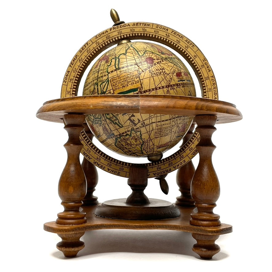
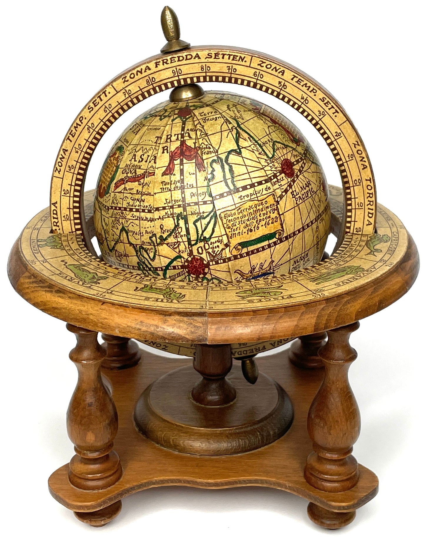
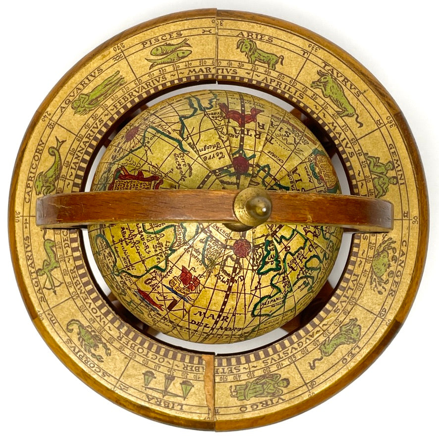
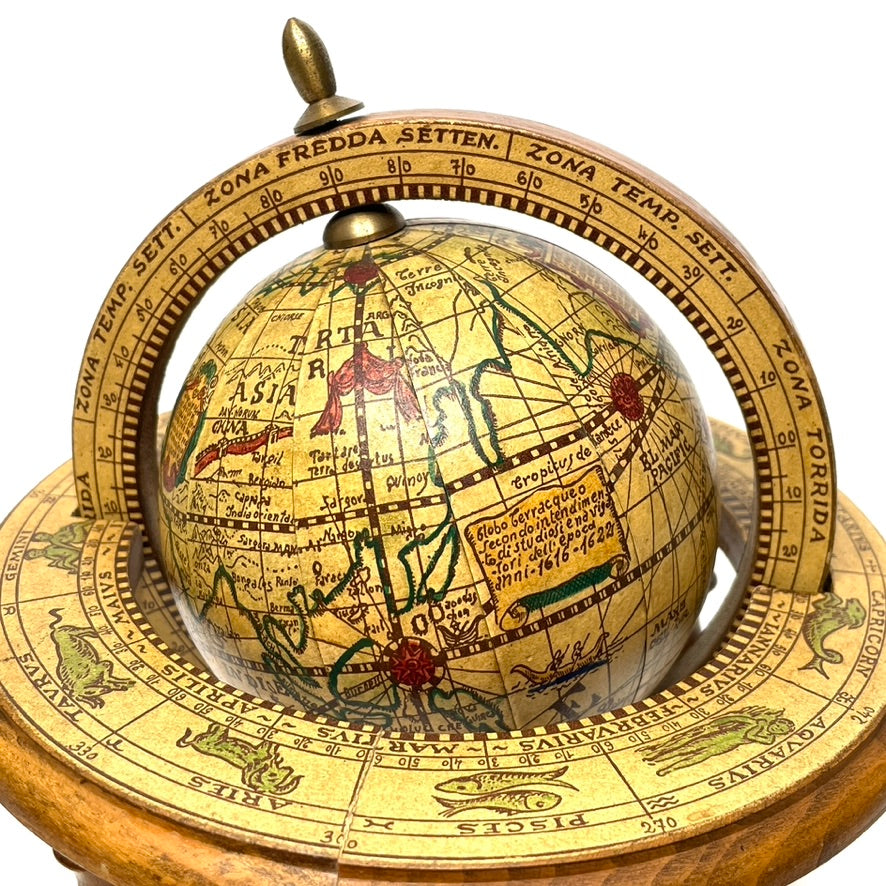
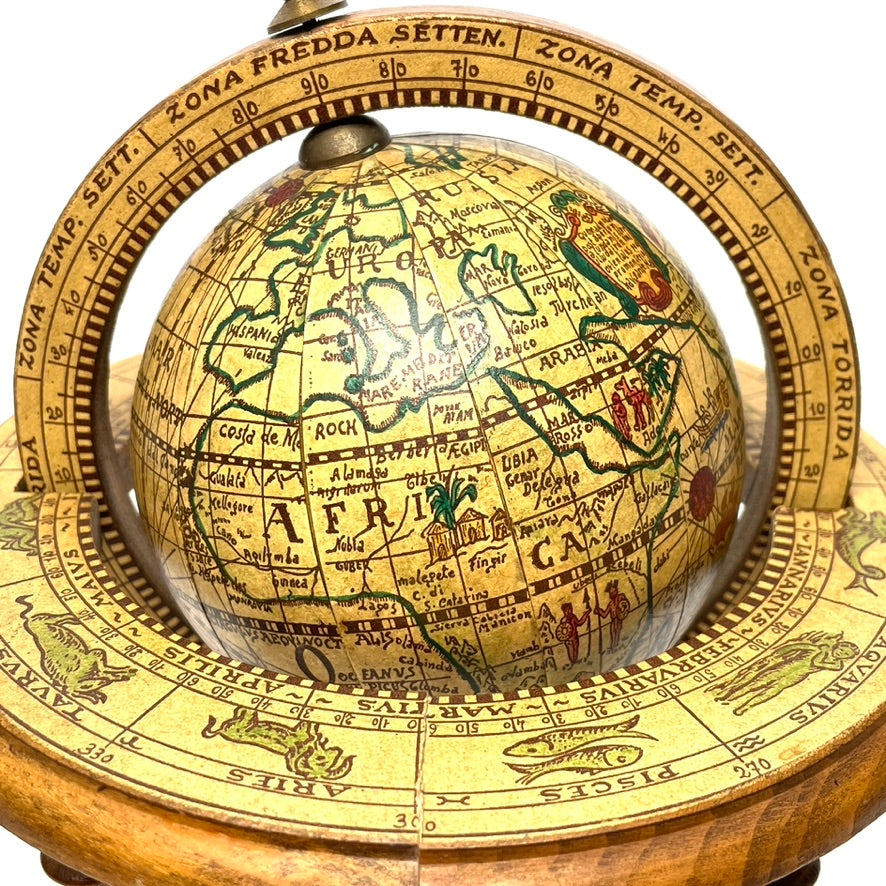
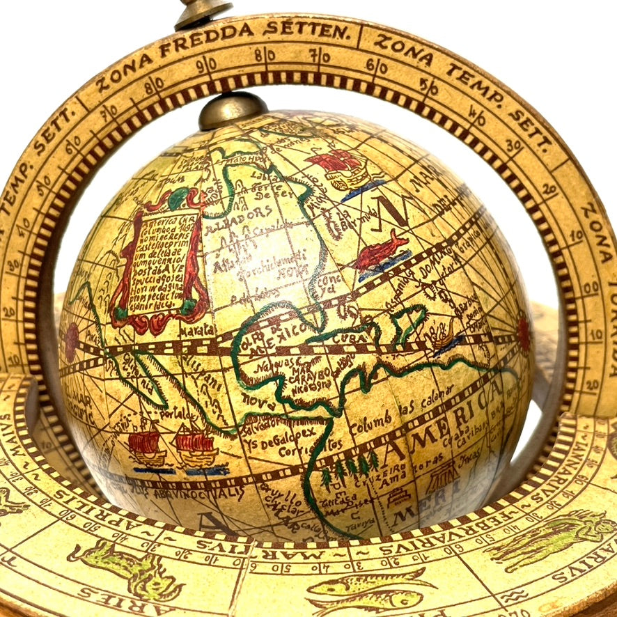
Finely crafted midcentury vintage replica of a 17th century Italian terrestrial globe, featuring detailed geographical maps of the era and a zodiac ring illustrating the celestial constellations.
Scroll illustration on globe reads "Terraqueous globe according to the understanding of scholars and navigators of the time 1616-1622"(translated from Italian).
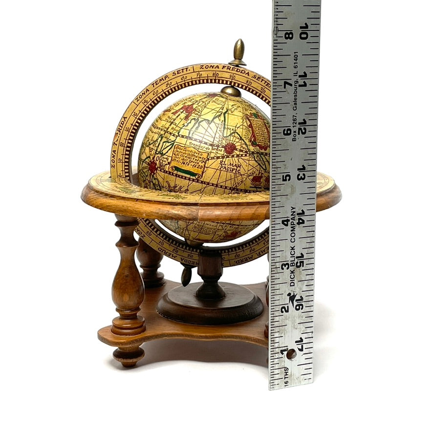
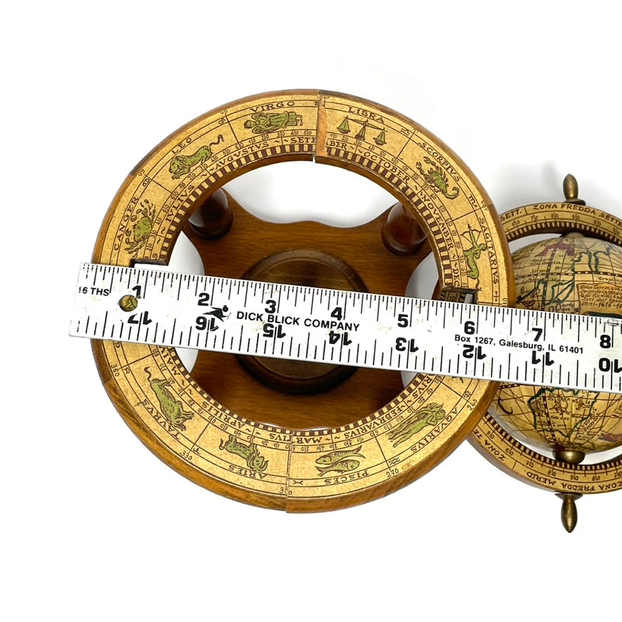
Just under 8" tall, about 6.5" in diameter at largest.
Additional info:
This globe shows how the Earth, comprising both land (terra) and water (aqueous), was perceived and understood by scholars and navigators during the period from 1616 to 1622. This timeframe is significant in the history of exploration and cartography, a period marked by advancements in navigation, the discovery of new lands, and the refinement of maps.
During the early 17th century, European explorers were expanding their horizons, traveling further to the Americas, Asia, Africa, and the Pacific islands. Navigators of this era relied on emerging technologies, such as the magnetic compass, astrolabe, and cross-staff, to chart their courses across the oceans. The knowledge of the world's geography was rapidly evolving, with new discoveries challenging and expanding the existing understanding of the globe.
Scholars, too, were contributing to this growing body of knowledge, drawing upon reports from explorers, integrating information from various sources, and using this data to create more accurate maps and globes. These maps and globes reflected the contemporary understanding of the world, showing newly discovered territories, speculative geographies, and sometimes even mythical lands.
The term "terraqueous globe" encapsulates this blend of land and sea, emphasizing the interconnectedness of geographic exploration and understanding during this pivotal period. The years 1616 to 1622, therefore, represent a snapshot of a dynamic phase in the history of cartography and exploration, where the collective efforts of navigators and scholars were gradually piecing together a more complete and accurate picture of the world's geography.